Afterburn: The Creek Fire Documentary
9/30/2021 | 1h 56m 53sVideo has Closed Captions
Never before seen accounts from the fire line and how Shaver Lake was saved.
Never before seen accounts from the fire line and how Shaver Lake was saved. A robust debate over the cause of the mega fires in the West from both sides of the fence. A look at how victims are rebuilding in the aftermath, and exclusive interviews with fire investigators, including the only statements direct from the head of the Sierra National Forest on the controversial cause of the Creek Fire.
Problems playing video? | Closed Captioning Feedback
Problems playing video? | Closed Captioning Feedback
Valley PBS Original Documentaries is a local public television program presented by Valley PBS
Afterburn: The Creek Fire Documentary
9/30/2021 | 1h 56m 53sVideo has Closed Captions
Never before seen accounts from the fire line and how Shaver Lake was saved. A robust debate over the cause of the mega fires in the West from both sides of the fence. A look at how victims are rebuilding in the aftermath, and exclusive interviews with fire investigators, including the only statements direct from the head of the Sierra National Forest on the controversial cause of the Creek Fire.
Problems playing video? | Closed Captioning Feedback
How to Watch Valley PBS Original Documentaries
Valley PBS Original Documentaries is available to stream on pbs.org and the free PBS App, available on iPhone, Apple TV, Android TV, Android smartphones, Amazon Fire TV, Amazon Fire Tablet, Roku, Samsung Smart TV, and Vizio.
Providing Support for PBS.org
Learn Moreabout PBS online sponsorship- [Announcer] Production funding for "Afterburn: The Creek Fire Documentary" provided by: (tribal chanting) By Reedley College.
Teaching the next generation of forest managers through its forestry and natural resources program.
By the Lazzerini Family Foundation.
Proud to support Valley PBS.
By Hedrick's Chevrolet.
Thanking firefighters for their heroic efforts in fighting the Creek Fire.
By InSight Vision Center.
Focused on supporting our communities affected by the Creek Fire and to the men and women who risked so much to keep us safe.
And by Valley Air Conditioning & Repair.
Dedicated to telling the stories of the Creek Fire that bring us all closer together and mountain strong.
(wind rustling) - [Narrator] Every story has a beginning.
A first step, a word, an action or a place that becomes a journey.
For one of the largest wildfires in California history, the story begins here at a single place on earth below the small mountain community of Big Creek, California.
Something happened deep in this rugged canyon that changed the lives of tens of thousands of people forever and blackened one of the most scenic expanses of the Sierra Nevada mountains for generations.
A single place on earth where the story of the Creek Fire begins.
- [Ty] Well it was probably in January.
- Yeah.
- Yeah.
- [Jeff] Snow on the ground, or?
- [Ty] There was no snow in January.
We came back again in February and there was snow.
- [Jeff] Yeah.
Was there any signs of anybody else being down in here?
Like the Forest Service or any investigator type things?
- [Ty] Yeah, we had a tip that the investigator was coming out here.
So we came out to see exactly where he was going and what he was interested in.
And there was snow on the ground at that point so we were easily able to see right where he went.
- [Fire Radio] Sixty Charlie.
Structure Group, go ahead for 60 Charlie.
- [Firefighter] Up here we got heavy fallout.
The spot's taking off.
- [Fireman] Yeah, copy, I'm gonna pull their other engine out of Rock Haven breaks.
30 Charlie used at Rock Haven.
Structure Group, make your way north of 168.
(chainsaw roaring) - A lot of people have seen the photograph of the smoke plume coming down from Big Creek or the photo taken from Big Creek.
That one shot everybody has seen.
- Yeah.
- Did you use that to help figure out where this was?
- That's what, yeah, not personally, but friends of mine used that and a laser pointer from the point to triangulate a spot.
- Get close.
- And then dropped a pin on Google to where we had some coordinates.
- [Jeff] Okay, so, but you haven't seen the aerial picture from Air Attack 15 at that point yet?
- No, from that angle it's still hard to tell how steep the hill is and stuff like that.
- Yep.
So what we'll do is, when we get down here a little lower, we'll pull my cell phone out and we'll look at that aerial photograph.
'Cause that's how we were able to really dial it down.
- Yeah.
- Yeah.
There's a lot of Oak in here.
There's some Ponderosa Pines.
There's actually some Sugar Pines down lower, too.
But this would have been really hard to get through.
This road down a little lower, there's some parts of this road, and you probably know this better than me, that are unburned.
So you can see what it looked like.
- [Ty] Yeah.
- [Jeff] All right, bud, so what are we looking at here?
You stopped here for a reason.
- Yeah, so when we came out here in February with snow on the ground, a day after the Forest Service investigator.
Followed his tracks directly to this clearing over here.
It's about 60 or 80 feet by 200.
Clear, no stumps.
It's been cleared for a long time.
So that's what he was interested in.
If there were a marijuana grow out here, that's where it would have been.
Someone came in well after the fire and ran a dozer in there.
Back and forth with no blade down.
Back and forth, back and forth.
Tons of times over that whole clearing.
- Why do you think that is?
- It's hard to explain.
I can't come up with a reasonable explanation.
- [Woman] All right, there's the husband, the kids, the dogs, the goats.
There's the fire.
You can see the smoke in the air, all the little pieces of particulate matter.
We put all of our explosives away from our house and we have our car over here.
It's packed and ready to go.
Hoping it's goodbye but not goodbye forever.
(sirens blaring) - [Narrator] For those who lived through the Creek Fire, those that experienced it, those that fought it, suffered loss from it, or barely escaped with their lives, the images of Labor Day weekend 2020 will be tough to forget.
In every way, this was the perfect storm.
A holiday weekend in the year of COVID-19.
For many, the first time to get back outside and reconnect with friends and family.
A forest overrun with millions of dead trees.
Skeletons explosively dry after a plague of bark beetles exploited years of drought.
Thousands of tons per acre of dead and downed fuel slowly growing on the forest floor left unchecked in the absence of a once thriving timber industry.
A changing climate giving a neglected forest choked with fuel the conditions needed for a fire to run.
A heat wave in Central California with temperatures over 100 degrees and single digit humidity levels fanned by unusual wind patterns for late summer.
And a source of ignition to bring flame and cause to a fire that would burn nearly 400,000 acres over four months in the heart of the San Joaquin River Watershed and the Sierra National Forest.
Most of what we know about the first few days of the Creek Fire was memorialized with smartphones capturing the first moments of a small fire in the canyon below Big Creek.
To the realization on Saturday, September fifth, that a major wildfire was growing by the minute.
To surreal images of a daring helicopter rescue of over 200 people surrounded by flames.
And the devastation of a place home to so many.
A reality that is still hard to accept.
But what most haven't seen or even heard is what actually happened on the ground in the first days of the Creek Fire.
- [Firefighter] We'll start scouting spots.
Turn around and push the other direction.
- [Narrator] From the initial attack on Friday, September fourth, to the heroic effort to save the community of Shaver Lake, so much of the story of the Creek Fire has been left to imagination, rumor, and theory with no shortage of concepts on how the Creek Fire actually began.
- [Jeff] Can we be looking at the exact tree that was hit by lightning that started the Creek Fire?
- [Narrator] As a filmmaker and storyteller, I knew this event would shape the next year of my life.
I needed to know everything I could about how and why this happened.
Our entire community needed to know to heal, understand, and move on.
Some of the images you are about to see are hard to watch.
Some may recognize burning structures as a family cabin or home.
I've wrestled with how to tell this part of the story and mean no disrespect or lack of compassion to those who've suffered this kind of loss.
But this loss is part of the story.
Part of how we all understand what really happened those first few days hidden beneath the smoke.
- [Jeff] Where were you when you first got the call about the Creek Fire starting on September fourth?
- It was a Friday evening, September fourth.
I was just arrived home.
Not too long before that, I was at my home in Prather, California.
I received a call from our command center about 6:30 that we had a fire start in the Big Creek drainage.
The tree mortality I knew in that area from being down the Huntington Lake Road a few times that it was pretty bad.
- My family's always had property up in the Big Creek/Camp Sierra area.
Even from the time I was really first born, I've been running around these mountains.
I've worked up in the mountains in the summertime throughout high school and college.
And when I went onto the Sheriff's office, I started out volunteering for our search and rescue team even before I was a deputy sheriff.
The fire started on the evening of Friday, September fourth.
That was the Friday of Labor Day weekend.
I had actually just arrived up here.
Friday was my first day off of a weekend.
That's my normal day off.
And I arrived up here.
I got dinner, played with the kids, doing a little bit of stuff getting settled in for the weekend.
And then I had heard, actually from somebody in Big Creek, that smoke had been seen in the canyon, and I went to a vantage point where I could look down in the canyon.
I saw the smoke myself.
- So when the fire started, we got on it right away.
We were the first aircraft on the fire.
We had this tanker on the fire and a helicopter out of Batterson, which is up in the Oakhurst area.
Helicopter five-three-four were on that fire.
The pilot that was here, they put retardant on the fire.
They put water on the fire that night.
What the issue was with it, in that canyon so late in the day, the shadows, they couldn't do a whole lot.
When you're down there at low level in that canyon, which is tight in the middle of the day when there's sun in there, with all the power lines that are in there.
There's a spiderweb of power lines.
It runs on the road to Big Creek and all the stuff that obviously comes out of a power house.
It was like the most perfect placement to have something start.
- When I first received the call, I was actually assigned to the August Complex on the Mendocino fire.
And the thoughts that went through my mind initially was that I knew the area very well, I knew that it was a very high threat area, I knew the resources that were around it and what was at risk.
And I immediately contacted my supervisors, let them know that I was gonna need a backfill to take my place on the August Complex so that I could immediately get back to the Sierra and tend to this incident, knowing that it was likely to turn into something fairly larger.
At least it had the potential to.
- I had recently come home from the LNU Complex the night before so I was in bed asleep.
Probably 12:30-ish or sometime that night, I don't really remember the time 'cause I was very tired from being up north, Chief Johnson called me and told me where the fire was and said I need you to go take a look at it.
- [Narrator] For everyone not living directly in Big Creek or Camp Sierra, how the Creek Fire was handled the night it started by the Forest Service and Cal Fire has been an ongoing source of debate, speculation, and misinformation.
(sirens blaring) The stories spread as fast as the fire itself that the Forest Service let it burn on Friday night or refused help from Cal Fire as part of the initial attack.
Both are untrue.
- [Dispatcher] At Camp Sierra.
- [Firefighter] Copy, 4350-- - [Narrator] The initial attack on the Creek Fire on the night of Friday, September fourth, included air attack, a hand crew, dozer crews, and cooperation between the United States Forest Service and Cal Fire.
- I helped direct the crews in.
I know the area well since I've worked here for 30 years.
I helped get the crews into the fire.
I was the lookout providing them information about what the fire was doing.
I did that 'til, oh, the crews got onsite.
And at that point I switched in to start do some line scouting out for the divisions, the firefighters that were out managing the fire.
And so I was assisting them, assisting Cal Fire in getting the dozers into the right spots and on the right road systems, getting gates open.
Pretty much did that until about 10:30, 11 o'clock the next day.
- Initial, I think we got a CAD page probably, I don't know, six, seven o'clock at night saying that the Big Creek Fire was three acres.
And I remember looking away, I'm like, oh okay, that thing's done, the fire's wrapped up.
And I was getting ready to go to bed that evening to start my trip down into Southern California.
Probably fell asleep about nine o'clock at night.
And my phone goes off about 1:30 in the morning.
My pager and my phone at the same time.
And I remember reading the CAD page and it says Big Creek, go to the Creek Fire with the dozers.
And it's 600 acres.
I figured there was a typo.
It's timber, there's no way.
Called the command center immediately.
And hey, just confirming, we're going to the Creek Fire.
And did I read the page right?
It's 600 acres.
Yeah, affirmed.
Get going.
- So September fourth started like a normal day.
We were at draw-down levels here in the unit.
I had heard that there was a fire on the Sierra National Forest in the Big Creek drainage late in that afternoon.
I didn't get called initially.
My partner, Battalion Chief Matt Dunham, was a Cal Fire battalion chief responding to that incident with Cal Fire resources on initial attack with the Sierra National Forest.
- [Firefighter] He is gonna be the one that called in.
- Fire units arrived.
From where we were watching it, we could see the initial air attack on the fire.
- [Jeff] About what time of day was that?
- That was right around dinner time.
So it was gonna be right around six o'clock.
- [Jeff] Okay, and when you say you saw an air attack, you noticed Air Attack 15 overhead that's spotting.
And if I understand right, there was a fixed wing and a rotary wing in here.
- That's correct.
And we saw both of those.
We saw the fixed wing and we saw the helicopter.
We saw the helicopter do a drop.
We saw the fixed wing do a retardant drop.
And about that time, ground-based fire resources were arriving at Camp Sierra and patrol deputies were arriving at Camp Sierra.
- [Jeff] You guys have known each other a long time and there's a certain level of respect and trust that you have for each other.
And when your boss called, and I'm assuming he was your boss at the time-- - Oh yeah.
- [Jeff] When your boss called and you knew where this fire was, you knew no matter what you had to be there.
there's no way you're missing this one.
- No, I left.
- [Jeff] Did the Forest Service call you for help initially?
- Our dispatch centers are co-located.
They're in the same building right next to each other.
So when one has a fire, the other one's immediately aware of it.
When the tree mortality happened, and right after the Rough Fire, we sat down with the Sierra National Forest and we determined what we called mutual threat zones.
So we set up these boxes of response areas basically on both sides of our borders that said if you have a fire to immediate threat to me, I'm going to respond also.
If Cal Fire has a fire that's close to the border, the Forest Service is immediately gonna respond to it.
Because it's a mutual threat to both of us.
So that's what we had to have in place for a number of years and that's the way it worked on September fourth.
The issue was we were three weeks into a fire siege that was caused by lightning in California.
Resources were stripped across the state, the Fresno-Kings unit was no different that day.
We had a limited number of engines.
Our dozers were just coming back in the unit.
They were already assigned to another pre-position in Southern California.
It was just a bad time on a bad day in a bad place.
- After that initial assessment, a significant amount of resources were ordered up for the incident and an initial attack took place to try and confine it to as small a perimeter as possible.
It quickly became evident that we were not going to be able to contain its perimeter that first evening.
And so they shifted the strategy from perimeter development to structure defense.
And by about 21:00 that evening, or nine p.m., the fire had already grown from about three acres up to over 200 acres.
- On that normal day, a fire in the Big Creek drainage would have gotten them at least eight engines, two dozers, and two helicopters, two air tankers.
The fed response on the aircraft would have been the same.
But we would have had all that equipment coming.
On that day, we were able to send three engines because we still had the whole rest of the unit that we needed engines to cover.
And for the next heart attack, for the next fire, and our initial response into the Big Creek drainage was only three engines and a battalion chief.
- [Jeff] From just looking at it, it's a pretty tight, the properties are tight together.
Structure protection in here, Cal Fire had, or Forest Service, had structure protection all in here.
- Yeah, they did.
And this is where the initial command post was for fires.
So the very first night when Forest Service and Cal Fire was converging on it, this is where they met.
It was right here by this flag pole.
That was the initial incident command post for everybody.
- [Jeff] I'm trying to understand timeline.
So the fire's reported around 6:30.
We've got a type one helicopter that puts two buckets on, two loads on it.
- Yup.
We've got a larger tanker 160 that does a split load drop on it.
And they both report a single tree candlestick with a little bit on the ground.
Their reports initially were the helicopter said about an eighth of an acre, the plane said it was larger.
I get that, the helicopter's slower, and can get a better look at it.
At that time, I know Ramiro was on lookout and he's bringing resources in.
Are those, some of those resources, you guys?
- Some of those resources, like I said, the three engines and the battalion chief were ours.
- [Jeff] Was part of that initial attack.
- Was a part of that initial attack force.
I grabbed my handy talkie, my radio at the time of dispatch, and turned it on.
I was having a hard time picking up a lot of the Sierra traffic coming out of the Big Creek area just because of the terrain from where I lived to where it is.
But I was getting bits and pieces of it and I could certainly hear our battalion chief when he got in the area.
And just he like is out there, most people are saying it was two to three acres.
It really wasn't doing a whole lot.
My battalion chief, when he got on scene, gave me a phone call 'cause he had good cell reception in the area he was in and gave me the same thing.
That it wasn't doing a whole lot.
- [Jeff] I was surprised to learn, because I fell under the spell of all the other rumors that were out there for a year, that there were two hand crews put into the fire that went direct on the fire early on.
Were those Cal Fire assets or were those Forest Service?
- Those were Forest Service, I believe.
We didn't initially stick any hand crews because we only had one crew available in the unit at the time, I believe.
And the battalion chief that responded for Cal Fire was informing me of that, that they were attempting to go direct, they had a dozer on scene.
Dozer two from the forest.
They were pushing into the fire.
The trouble is the most dangerous thing you can do is fight fire that's downhill from you.
The really most dangerous thing you can do is fight fire in a river canyon downhill.
And if you read back in history, we've historically killed a lot of firefighters in that scenario.
So they were very careful picking their way into it.
But as the battalion chief would call me about every hour.
I never went to sleep that night.
As the hours ticked by, the crews are making progress, they were getting into the fire, they were trying to get a scratch line going around the fire.
Up 'til about midnight, it had only grown to maybe five acres or so.
And then something changed.
- The first evacuation order that was issued was issued for the community of Camp Sierra and the units that were on scene at the time started that process.
The sergeant and the two deputies that were at Camp Sierra started that process at that time.
And from my perspective, I have to say that one of the best decisions that the Sheriff's Office made early on was a decision made by that patrol sergeant to leave those two deputy sheriffs in place.
We didn't send them to any other calls for service.
She made sure that they stayed here just in case the fire took a turn for the worse.
Because that's exactly what happened.
- I remember initially getting there as the dozers were getting loaded, I put the drone up in the air, and tried to get some, a vision of the map of where this fire was going.
As we put it up in the air, in a timber fire, you have no idea how far it's passed.
Put the drone up and I could see, the fire was already past the location I was at.
And I was like, okay, let's get the dozers unloaded and let's start tracking them around.
- And the fire stood up, and, by 12:30, one o'clock, it had crossed the Huntington Lake Road, which was my trigger point when he called me and he said, "Chief, it's gone across Huntington Lake Road."
That's when I said whatever I said to him.
(Jim chuckles) And I hung up the phone and I called Jim, and I said, "Dude, you're the last person I want to wake up right now 'cause this has been a rough month, but I need you."
- We got in there very quickly.
We did try to go direct both with hand crews and with dozer.
We had a significant amount of air resources also assigned.
The fire became extremely intense.
We had to back off.
We went in a second time, tried to reestablish that direct line.
At that point with the darkness setting in and the intensity picking up, that's when the decision was made to shift from trying to control the entire perimeter to again providing that immediate structure protection.
- One of the chiefs from Cal Fire, Jim McDougald, called me on the phone, and the first thing he said is, "Are you there?"
Because that gave me an indicator of just how bad this was also.
He gave me-- - [Jeff] He was worried about you.
- He was worried about the entire thing.
And he also wanted information about what was going on here.
The tone from his voice gave me an idea of just really how bad this was.
And that was about the time that I was logging on and heading up the hill.
And he had told me that he's got a bunch of bulldozers that are headed up, and I relayed to him that Huntington Lake Road had just burned over.
He said it didn't matter.
They could drive right on by it.
And then he called me back about an hour later and said the fire's too bad.
They have to take the bulldozers up and around the long way.
Which for me is not good news because the long way around means that all of that equipment has to go up 168 to Huntington Lake and then down Huntington Lake Road coming into the back of Big Creek.
And what that means for me is that we now are gonna have fire equipment coming down a one lane road that is also the road that we have to evacuate all of the Big Creek out of.
- [Jeff] With sunrise on Saturday, September fifth approaching and the fire making runs in multiple directions, the evacuation of Huntington Lake began next.
The flames slowed on parts of the mountain where Cal Fire and Forest Service fuel reduction programs had been put in place in concert with Southern California Edison's forestry department.
But too much of the Big Creek Canyon was a tinder box of dead and down fuel, beetle kill trees, and thick dry brush.
Now a chess game was beginning.
Where to move the pieces to make a stand against a fire now raging out of control?
And for Kathy Curtis in charge of the evacuation of the entire mountain area for the Fresno County Sheriff's Office, some tough decisions were about to be made on how to safely move 28,000 people off of a burning mountain.
- As soon as we evacuated Big Creek, the next thing was the west and the Huntington because the fire was starting to just race right up that canyon.
Huntington Lake was a challenge for us because the fire was coming so fast.
- I was staying on the phone trying to procure as much equipment.
- [Jeff] He was your eyes and ears.
- Yep.
- Yeah.
And actually, when I got there, I became the unified IC of the fire.
- You did.
- Yes.
- [Jeff] That's a big responsibility.
That's a big responsibility.
How long did you do that for?
- Shoot, two and a half days?
- [Jeff] The worst part of the fire.
The worst two and a half days of the entire fire, you had to be unified incident command on that.
- Yeah.
- Yeah.
- And operations, and-- (Jim chuckles) - So Saturday morning, I remember we had a little bit of a transition.
So I initially went up as a dozer strike team leader.
And a lot of times we'll get rolled into another operational function.
So I still have the responsibilities of the dozers and then I became the division group supervisor.
I was Division Mike on the initial.
And basically the footprint that I was working in was the edge of the fire from the base of what I would call the east of Shaver Lake to the west end of it.
It would've been closer to Musick Mountain at that point.
And that was my chunk of dirt.
Trying to capture in the terrain that was, the backside of Musick Mountain is all rock, it's very steep country.
We've gone to a lot of rescue calls in that area.
So where are you going to be able to put some of those resources?
- So this is a place that I stopped the other day when I hiked down here to check this place out.
You can see the crescent granite features of Big Creek with those amazing waterfalls down there.
And that's really, when you look at this picture from Air Attack 15.
Now Ty, you've had a chance to see this real quickly.
But when I zoom in here, there's our crescent, right?
- Yeah.
- There's the crescent out there.
You know this spot well.
Now, when you're looking at this, that smoke plume looks like it's further down in the canyon, like it's down below us, right?
- Just right down this ridge, it looks like right at the top of the canyon, kinda.
- It is on the spine.
- Right on that spine right down in there, yeah.
- Because this other creek coming in right here, you can see right here, this scene.
That's the other creek, that's this creek bed right here.
So this smoke plume is right down below us real close to where we're standing.
Within, I'd say a couple of hundred yards, wouldn't you?
- Yeah, for sure.
- Okay.
So what do you want to do next?
- I've been down in this area already.
So I've seen a couple of odd things down there.
Now knowing that we're even zeroed in more right here-- - Your interest is piqued now here.
- Yeah.
So we'll go back down in there again.
- What kind of odd things have you seen?
- There's an area just over to our left where there's about five or six red flags that were not for the timber sale, so they're unexplained.
They could have been an investigator.
And then there's also two or three stumps of trees that were fallen well after the fire.
Green trees that were unexplained why somebody would come in here and fall those trees afterwards.
- Well, we're gonna have a chance to talk to Cooper next week.
So that's definitely something I'll ask him.
- [Narrator] The morning of Saturday, September fifth, 2020.
At this point, the Creek Fire was known mostly to firefighters, first responders, and people directly impacted in places like Camp Sierra, Big Creek, and Huntington Lake.
But as Central California woke up and turned on the news or headed up to the lake for the weekend, the scope of what had happened in Big Creek Canyon the night before was becoming clearer.
NASA documented a massive pyro cumulonimbus cloud believed to be one of the largest ever seen in the United States.
By this time, Lieutenant Kathy Curtis and the Fresno County Sheriff's Office had a full evacuation in place with evacuation orders spreading to communities down the mountain.
- So when I got assigned to the Creek Fire, when I stopped by our emergency command center, I immediately made contact with my boss, Division Chief Jim McDougald, who was already up there.
He went up there two in the morning when our unit chief, Mark Johnson, tied in with him and said, hey, it's in what we call the Ely BMP.
It's an area on Southern California Edison ground that we conducted prescribed fires for the last two years in.
The fire was actually held up in the Ely BMP.
It made a difference.
It bought us two days to come up with a decision on how to divert the fire out of Shaver.
- Yeah, so the chief came to me and said I need you to take some engines up there and come up with a plan to protect the community of Shaver Lake and the Ridge Top subdivisions.
I teamed up with Marc Bontrager.
He became Shaver Structure Group and him and I worked directly together with Chief Wittwer that was already up there with the dozers.
So my goal and my sole responsibility was the homes, the businesses and the homes.
And we went from house to house, coming up with a fire deployment defensive plan for each one of those communities from the point on south on, downhill, all the way to Cressman.
- So basically I looking to the north towards Mammoth Mountain which lines up with Musick there, Jeff.
I was sitting there talking with some of my neighbors.
Okay, they're bringing the planes around right now.
They're getting into the wind, they're gonna drop.
And you could see the retardant getting blown like a couple wind spans into the fire.
I'm watching the lead lineup again, and from a different angle, taking that into consideration.
And it was still getting blown all kinds of different directions.
So basically what was happening by this time was the fire was making its own weather.
It was making a pyro cumulus column that had downdrafts.
And so the wind's coming out of that all different directions and we weren't gonna be effective from the air pretty much by that time.
I've got some pictures from a partner of mine in Air Attack 51 that they were at, looking the column at, the column was up to 20,000 feet and they couldn't even get into it to shoot any footage with their IR cameras to see where the thing was at.
- [Narrator] As daytime temps heated up and strong southerly winds began to blow, the fire behavior became aggressive and sometime around midday, began to spot out in front of the northern head of the fire.
Jumping the San Joaquin River near Kinsman Flat, where it began a record-setting run and rate of spread to the north towards hundreds of people camping for the weekend at Mammoth Pool Reservoir.
- So I knew there was a fire.
I have friends who run cattle on the other side of the river, some really good friends.
So we knew there was a fire.
We didn't, nobody knew how big it was.
As far as I knew, it was just a little, my understanding was it had maybe been a campfire that had gotten away from someone.
And I thought they had it under control.
- By 10 o'clock that morning, we had already ordered our first type one incident management team to help us out with it.
By that afternoon, I had put in the request for a second type one team.
That's not unprecedented, but within the first day of an incident to order two type one teams, that's pretty uncommon and that sends a very strong signal that what we are looking at is something that is not that common and is really gonna need significant response in order to be able to get control of it.
- [Jeff] Did you put that second order in for that second IC team when it jumped the San Joaquin River?
Was that the trigger for you?
- Yes, as it was really picking up momentum and jumping across the San Joaquin, which was the first time we've ever had a large fire do that on the Sierra, at least in its recorded history, it became very clear that we were gonna need two incident management teams.
Just given the topography of the Sierra, it's very difficult to get from one side of the forest to the other without going all the way around.
You can't just cut straight across very efficiently.
And so that's why we needed an incident management team on both the south side, the High Sierra Ranger District, and the northwest side, the Bass Lake Ranger District.
- So my family not only runs the cattle up here, which I guess to better explain it, so my dad and I run the cattle.
So my aunt, Amy, runs the store and the campground.
So, and yeah, Labor Day weekend is one of her busiest weekends.
It's the last big weekend before pretty much the end of the season.
And it was packed.
And not only her campground, but there's other campgrounds around us that are packed, and the lake is packed.
People camp everywhere.
On the lake, there's campgrounds on the lake, there's campgrounds everywhere.
It was a very busy weekend.
- [Narrator] As the enormous pyro cloud of the Creek Fire towered overhead, people on the north side of the San Joaquin River in Madera County were paying attention to the blaze but completely unaware that the fire had jumped across the river 10 miles to the south and was now running back up the river directly at them.
Ashley, her son, friend Peter Suski, and her father, Craig Wagner, were all about to begin gathering cattle after the family's summer grazing permit with the Forest Service was coming to an end for the year.
This family has been a part of these mountains for several generations and understands how wildfires burn here.
By early afternoon on Saturday, September fifth, the Creek Fire was recalibrating what the Wagners knew about fire spread.
- [Jeff] Take me through what got you here.
Like where did you physically see the fire and about what time of day was it?
- Well, it started off in the campground.
That's when we saw the fire first.
Then it jumped from Mile High to the Borrow Pit, which is the other side of the campground.
Then about 10 minutes later, it started over here.
And then that's when we went back up, got everybody, and came out here.
First we came through the fire, the grass was on fire.
And when we were here, it was still pretty clear.
Then all of a sudden those trees just blew up in flames.
- We had no official warning of hey, there is a fire.
We were making phone calls to the Forest Service to get confirmation before we freaked out a bunch of people.
I was calling Cal Fire.
They didn't know yet.
'Cause it happened so fast.
No one knew what was really going on.
And at that point, all I was worried about was my dad, and my son, my friend, and my animals.
And my aunt's like, okay, I need to go tell some people to leave.
And we're like, okay.
She backed up in her side-by-side and went up on top of a hill, not a very big hill, and just enough to look out and see.
And she could see that the fire had jumped to Sweetwater.
So there goes our road out.
The fire's in front of us and the fire is behind us.
So she's like, all right, I'm going to tell people right now.
There was no way to drive out.
At that point, it's everybody get to the lake.
And so from that moment, my dad and I jumped in the side-by-side.
My son was back at my cow camp with my friend.
And as we were driving out, our campground, right before you go to cross the bridge, there's like a little camp spot right there.
That camp was on fire.
And there was kids running around screaming.
I mean, didn't, nobody knew.
No one, those people had no idea there was even a fire.
- [Narrator] By mid-afternoon on Saturday, the northern flank of the fire, driven by strong southerly winds and hot dry weather, was advancing at an alarming rate.
In just a few hours, the Creek Fire ran along the backside of Shuteye Peak at a record-setting pace, scorching 15 miles of forest.
Within the first four days of starting, the Creek Fire rapidly exploded, expanding between 20,000 and 50,000 acres per day.
Game cameras set up for the fall deer hunt on Whiskey Ridge above North Fork captured the speed at which the flames moved.
Images of forest wildlife literally running for their lives.
Forest aviation officer and air tactical group supervisor, Mark Bertuccelli, flew hours of missions over the Creek Fire in Air Attack 15, the spotter plane also known by its tail number 700 Papa Quebec.
- Between us, we come up with a plan on what we need.
What'll work in this area?
What planes will work best in this area?
And, a lot of times, when it's as busy as it was, we had a lot of fires going in the state at this time, it's what's available.
So I'll ask, hey, you want the VLAT?
And they'll either come back with a yes, we'll take the VLAT right now, or no we won't.
But it's generally on their suggestion on we've got a lot of ground here, this'll cover it really quick.
It'll work in here because they're the ones that are going low level, checking the air, checking the obstacles that are out there.
And they know whether that plane will work in there.
I make the suggestion, I'll make the order, but they're generally the ones whether it'll work or not.
- [Narrator] When Mark is over a fire, his job is to help develop a plan with crews on the ground about how to stop the fire using planes, helicopters, dozers, and strike teams.
- And the smoke is laying in there so bad right now that I just got back from it, and I couldn't even, we're flying at 12,000 feet just to be above the smoke and we can barely even see the ground.
So the limitations are, we have to be able to see where we're dropping and there's wind limitations, too.
There's visibility limitations.
And just because it's big doesn't mean it's the best.
Sometimes the Cal Fire S2 is the best platform for what we're trying to do out there.
It's just the Air Attacks working with the lead plane guys and the tanker guys to come up with a plan of what's gonna work best.
Sometimes we'll drop a VLAT out in front of the fire and we'll work a smaller tanker from a corner to that.
So it's having all the right tools in the toolboxes is the key to it.
- [Narrator] On September fifth, as the Creek Fire roared into late afternoon, hundreds of weekend campers caught off guard by the firestorm ran towards the shores of Mammoth Pool.
Some literally getting into the lake to escape the intense heat.
The flames and thick smoke made air operations too dangerous for an all out air attack.
And for Ashley Wagner and her family who stayed behind at their cow camp in nearby Logan Meadow, time had run out.
- There was fire coming at us from literally every direction.
It was coming towards our camp, it was coming from back over this way, it was coming from behind us because, I guess, the actual main part of the fire was still coming up the river and these were just spot fires all around us creating more fires.
All I was thinking about is I have my son and I grab every dog I could find.
I didn't grab, we had water, I knew we had water 'cause we always keep water in our side-by-side.
And I knew we had snacks.
My dad's a diabetic so he always has food.
So I didn't grab any food, didn't grab water, didn't grab my diaper bag.
I had nothing.
All I did was go around, I was grabbing dogs, holding my son in one arm, grabbing dogs, throwing them in the Ranger, tying down whatever I could.
My dad told me, get in, let's go.
And I got in with him and we drove away.
I wasn't nervous.
I'd never thought that this was how I was gonna die because there was no way I was gonna die that way.
There was no, I wasn't gonna let myself think that way.
I had a baby with me.
I have a two year old at home.
That's not the way I'm going out.
And my dad and I sat there for a minute and he told me, he said, stay here, I'm gonna go look for your aunt.
He drove away.
And he disappeared.
'Cause at that point, for whatever reason, the wind shifted and it got smoky.
And so we're standing in this meadow and I told Peter, I was like, we can't stay in this meadow.
The grass is gonna burn.
I mean, it was green and the grass wasn't super high, but I'm like it's gonna burn and we need to get to a better spot.
My dad showed back up and I told him, I said, we need to get to the pond.
And he was like, okay, follow me.
- [Man] Here's one for the books-y boys.
- [Narrator] With spot fires now surrounding Logan Meadow and the main head of the fire charging directly toward them just minutes away, the Wagners made their final stand against the flames in this small pond.
For the next hour, they sat huddled in their all-terrain vehicles, fire raging around them, unsure of what was coming next or when it would end.
When the smoke cleared, they knew they'd made it through the worst, but not without loss.
In the middle of the firestorm, one of Ashley's dogs broke free in a panic and ran directly into the forest just as trees began to explode from the intense heat.
The dog was never found.
As the flames died down, Craig Wagner set out to see what was left behind.
- I sat there and this is where my dad said, I lost it because I told him, I said, our barn's on fire.
And he's like, I know, I know.
And I said, and then I, we're talking and I broke down.
I said I'm watching my horses burn right now.
And he was like, no, everything's fine.
Like broken down and I'm continuing like, okay, it'll be fine, it'll be fine, it's not fine.
I mean, like I could be watching my horses burn to death.
So in that moment, you just, you think about everything else.
And I'm thinking my horses, I put them in that corral to die.
So that was really hard.
And I knew my dad had a pistol and I told him, I said, either you or I need to go shoot those horses right now.
Like when it died down enough that we could get there, I'm like go now, you need to go down there and put them out of their misery.
And he said, I'll go, Peter and him will go.
I waited, that was probably the long, that felt like an eternity.
Sitting there waiting to hear those gunshots.
And I never heard anything.
So then I'm going through my mind, well, they're dead.
So, okay.
That's, it's done they're you know, okay.
When they came back maybe like 20 minutes later and they had another guy with them, Mike, who works for my aunt.
Peter said, everything's fine.
And I was like, you mean they're dead?
He's like, no, your horses are fine.
I'm like, don't lie to me.
Why would you, I mean, I was like arguing with him over it.
Like, why would you lie to me?
Why would you tell me my horses are fine?
And he, Peter knows me really well.
He had took a video of them and showed me there's nothing wrong with your horses.
And I'm like, couldn't believe it.
- [Narrator] At the same time the Wagners were emerging from the firestorm, I was driving Beasore Road 10 miles away with my family to spend the weekend with our friends at their cabin in Beasore Meadows.
Even at this point, so many people like us, not directly seeing or knowing what the fire was doing, continued to drive into the path of the Creek Fire oblivious to the danger.
The traffic coming down Beasore Road told me that we were passing people evacuating from Mammoth Pool and that the fire had jumped the river shutting down the normal path out of the reservoir towards North Fork.
But it wasn't until we arrived at Beasore Meadows that we realized something wasn't right.
The sky looked like something out of a science fiction movie constantly raining down large debris.
Some of it still smoking.
And then word from the Madera County Sheriff that it was time to go.
- Okay, it is almost seven o'clock and we've just gotten the evacuation order to evacuate Beasore Meadows.
The cabin is back there and the sky is looking pretty gnarly.
It doesn't seem like it's close, the fire's close, but the smoke's been getting worse and the sky is pretty angry and red and gnarly looking.
And we're getting reports that people down in Mammoth Pool are having a tough time and maybe even jumping in the river to save themselves from the fire.
So the sheriff went through the neighborhood here and just ran the siren and said get on out.
So we are on our way down after spending two days of prepping food and packing and getting up here.
(Jeff chuckles) Good old 2020.
- [Narrator] As we began to pack up and evacuate Beasore Meadows, hundreds were trapped on the shores of Mammoth Pool Reservoir, just a short drive below us, completely surrounded by fire.
Word was beginning to trickle into the incident command center of those caught behind the fire line.
For the Madera, Mariposa, Merced unit and Fresno-Kings unit of Cal Fire, a bold rescue plan was beginning to take shape.
- As the fire progressed through the day, and it was identified that we had a major issue both in Fresno and Madera County, my partner from Madera County called and was talking about some potential rescues on Mammoth Pool.
And we knew that, one, fire resources were limited, response times were limited.
I made the recommendation to him that we had used the National Guard with Black Hawks prior for other rescues in Fresno County.
Not knowing, five hours later, I get a phone call from our dispatch center that we have a rescue of 60+ burn victims inbound to the Fresno airport.
As I talk, I have complete chills and goosebumps because it's a surreal moment that you're like in a war zone.
And so my initial thoughts were we just lost tons of civilians, tons of firefighters.
What are we walking into?
- [Narrator] Completely surrounded by fire and stranded on the shores of Mammoth Pool Reservoir with no first responders, firefighters, or law enforcement to explain what was about to happen, two California Army National Guard helicopters descended through the smoke looking for a place to safely land.
(helicopter rotors whirring) Colonel David Hall, Commander of the 40th Combat Aviation Brigade out of Fresno deployed a CH-47F Chinook heavy lift and UH-60 Black Hawk helicopters with limited night vision capabilities to fly into the heart of the Creek Fire at Mammoth Pool.
In all that night, 242 people were flown to safety in three separate missions conducted in some of the most dangerous conditions these flight crews have ever faced.
- And so as I got to the armory at the airport, Fresno Fire, our staff, American Ambulance, they created this triage base for these incoming aircraft.
When that first Chinook landed and the people started coming off the helicopter, there was women, children, there was dogs, people in just shorts, dirty.
And, for whatever happened that afternoon and evening into that rescue, there was only three burn patients and they were minor burns.
So thankfully their report was wrong.
But just the mere fact that we were able to assist and work with the National Guard and they were able to fly in to the conditions that they saw and land and rescue those people was just probably one of the weirdest memories that I have of my career.
- [Narrator] For the Wagners, their cow camp, barn, and vehicles were all destroyed.
As well as the historic Wagner's Store that had been in operation since the 1950s.
Demolition on the store site began in July of 2021 with plans to rebuild the store and campground, continuing a long family tradition in these mountains.
- [Jeff] And you guys were all taken out on helicopter?
- No.
- Peter stayed.
- [Jeff] Peter stayed, you went out.
- I went out with the baby, and he went out on the last one.
- On the second or third one.
- I have no idea, I didn't even know helicopters were there.
- So like two, they came at left.
And you went out on the second wave.
Ashley went on the second wave.
And then Craig went on the third, last wave.
- [Craig] Yeah, the last one.
- [Jeff] Were you on a Chinook or a-- - A Chinook.
- I got a Black Hawk.
- [Jeff] You didn't get the double egg beater?
- [Ashley] No, I got a Black Hawk.
- [Jeff] How do you rate?
I think we're on, like we're right on it.
So let's start picking up detail.
This can here.
There's some glass over there.
There's something shiny right by you, Dave.
I can't tell what that is from here.
Let's just get all the detail.
One of the things I'm finding very interesting right now is the burn.
I'm looking at burn patterns on trees right now.
So hang on a second, man.
This is a trip down here, dudes.
Okay, one of the things, one observation I'm making right now is there's, okay so this black oak right in front of me, it has burn on one side of it, which is probably coming off this big dead snag here.
And then on other oaks like this one right here, the burn isn't on that side.
I'm trying to see if there's a pattern to how the trees burned.
This black oak hardly has any burn on it.
Are these the trees you said were cut down?
- [Ty] Yeah.
- [Jeff] So these are post-fire cut down trees right here.
One has to think why?
Why would you come down here and burn down, and there's markings on the stumps.
You can see where we are in relation to that crescent rock of the bottom of Big Creek.
And you can see the town of Big Creek right up above here.
Let's walk over and check this out.
- This seems very close to where it looks on that picture.
And you can see below, right below us, we got green that didn't burn.
- [Jeff] Could this be our lightning tree?
- [Ty] Possible.
- [Jeff] This could be the lightning tree.
Let's make sure we document this really well because they cut it down, I believe, to look at the inside of it.
By the way, check this out, Ty.
- Yeah.
- Come here for a second.
- [Ty] And they cut this one, too.
- [Jeff] Check this out.
I'm doing a little sleuthing here now.
Okay, here's the deal.
Here's what I see.
I see a tree that looks like it was struck by lightning because it's got the twist to it.
Okay?
It's got a little bit of the twist going on the higher up you go.
It's a pretty good size tree.
They obviously cut this tree down.
And then here's the thing you gotta look at.
That is not a stump.
That's a core sample.
- Yeah, a round-- - They took a section off to look at this specifically and that's unusual.
That's investigation happening.
Right?
So this section of tree came from this section here.
The cut's here, cut's here, tree came down, and then they pieced a section out to look at it.
To try to determine what's going on.
One of the other things that I see that I find interesting is the shape of the sap and the pitch layer inside the tree.
Inside the tree, the pitch inside looks baked.
Could have been from fire, it could have been from a lightning strike, but that's not normally how pitch looks.
It's brittle as hell.
So it's just falling apart.
That is the pitch from this tree.
And look it, okay.
Now keep in mind there was a damn forest fire here so that could have had something to do with it.
Also, this tree was standing during the fire, and was the heat damage enough to cook the pitch layer like that or is that a lightning fire?
Is that a telltale of a lightning fire?
We're gonna find out.
We're gonna ask that question.
- So when I got into Shaver, I immediately tied in with Chief McDougald, and he told me where the fire was.
It was backing around the backside of Musick Mountain, which on the eastern side is where we conducted those prescribed fires with Southern California Edison.
It was kind of hung up in there.
The fire was rapidly progressing up canyon towards Huntington Lake.
At that time, they already had operations running up there and structure protection.
A lot of the resources at the time were getting filtered up Highway 168 to Huntington.
The fire was on the backside of Musick Mountain.
Therefore we knew it was backing down into Jose Basin in the river drainage.
There's roads that we can take to get down into Jose Basin.
We could not get in there due to visibility to try to make access to see where the fire was, to see how far it progressed up.
But we knew it was going to be a matter of time before it came up Mill Creek and Stevenson Creek, which is on the west side of Shaver proper and all the communities on the top of the hill.
- I remember getting on the radio, Operations Division Mike.
And go ahead.
Hey, we're priority traffic.
We got 200-foot flame links at Flume Peak.
The fire's moving towards the east and we're gonna have structure impact within the next hour in the community of Shaver.
Heard copy.
I was like I need every additional resource that I need.
So I remember coming back down and met Chief Bontrager.
He hauled up right to where I was at.
I hiked him down to what we could see from the smoke, and he's like we gotta get out of here.
So I remember we come back down and we're right at the S-turns, right at the bottom of the dam where Shaver Rock is.
And we're coming up with a plan and Mark says, hey, we're gonna have to fire this.
And we didn't have a plan B and a plan C. We had one plan.
It was probably right about noon where the fire had started to make it all its way to the creek.
And we were probably within that 40-minute window of we need to make a decision right now.
I got on the air and asked operations.
I said, hey, we need a defensive fire basically from the bottom of the dam and we're gonna take it all the way through town.
Copy, do what you need.
And to think that we're just going to start putting fire on the ground from that point, our ending point was a long ways to go all the way past the point, all the way down past the community center, not knowing how long this operation's going to take.
- [Narrator] On Sunday, September sixth, as the Creek Fire continued to relentlessly chew up tens of thousands of acres of forest in every direction, the main focus for the Fresno-Kings unit of Cal Fire was to protect the community of Shaver Lake.
For many in Central California, Shaver Lake holds a special place in people's hearts.
For battalion chiefs Wittwer, Bontrager, and Bowman, along with their crews, this firefight was personal.
They all have long ties to Shaver Lake and friends, family, and strangers all counting on them to save the town.
With fire quickly advancing up the backside of Musick Mountain and into the Stevenson Creek drainage, their only hope was to light a massive backfire, nearly four miles long, hoping to send that fire directly into the head of the main fire charging down the mountain.
With dozer crews ready and strike teams in place, Chief Bontrager's team put fire on the ground and got ready for the worst.
- I had to wait 'til the main fire came 'cause I needed the fire's influence to influence my fire.
I needed it to pull in.
So it started to come out of Mill Creek the afternoon of the sixth.
You couldn't see it, but you could hear it.
There was at one point we had a lot of resources in place.
Not as many as I wanted.
We were very slim.
The resources they gave me, I kind of chalk it up that they were a mixed bag.
I had a lot of strike teams, the engines that were volunteer companies from up north, I had engines from San Francisco City, a lot of counties in the Bay Area.
Unfamiliar with the ground, you could tell their comfort level was not there.
I had to build that confidence in them to get behind the plan that we had and reassure them that this was doable.
We had fuel reduction projects out there.
It was gonna be successful.
We just needed everyone's buy-in and everyone to be with the plan.
(truck beeping) - The job that Jim and his folks with those dozers did on Friday night bought us basically a day and a half.
Because they, and this is something you don't want to do while I'm firefighting, is split the head.
But we had to, we had no other choice in this matter.
So the head of that fire got split at the head of Shaver Lake on Huntington Lake Road.
Part of the fire went to the east, the majority of the fire after it had made its big run towards Mammoth Pool, was now coming south.
In the meantime, on Saturday, it had given them time to put those dozers in and around Shaver Lake and start pushing dirt.
And you could see the fire when it hit it.
It was standing it up.
We call it standing it up 'cause it was laying over as it was coming through the timber.
At the beginning of Sunday, I wouldn't have given you 50 cents for the town of Shaver.
After we started firing, and you could see the progress that it was making and what it was doing to the fire.
When it was basically we had a fuel break on the top of the ridge, the wildfire was coming up the west side, our tactical firing operation was running in to the east side of that fuel break.
And you could see it, basically, I won't say going out, but it was going out.
It was no longer running in the timber anymore.
- Yeah, we had brought fire down 168 from Stevenson Creek through the switchbacks just below the dam.
Our fuel breaks, our dozer lines that we put in all night long working, were holding.
We were feeling pretty good.
We got into that Westlake Village behind what we know where the Hungry Hut is back into those subdivisions, very tight roadways.
A lot of places were just me and my pickup trying to deploy engines where I thought they could get in and get out quickly.
Very, very unsafe, and as a battalion chief leading them, there was a point of emotion to that with putting them at risk and putting our equipment at risk in driveways and in roadways.
They couldn't traverse when the visibility got to zero.
And so trying to pick those areas that we could deploy, maybe not safely, but as aggressively as we could that I could also get them out, was hard to pick those spots because the fire was moving so fast.
- One of the hard things was through this whole time of, as West Village, and we're starting to get fires into Ockenden and Dogwood, our phones are blowing up.
And I'm talking to my boss and he's trying to grab intel for me, I'm trying to relay information back.
Everybody's wanting to know about their property.
And it became to a point where I could tell you, right off the bat, your area's good, no bad news.
And it was like, we're doing good.
I probably went through eight different text messages.
Can you check this address?
Yeah, no problem.
Send a picture back of a nice cabin, not affected.
There's fire burned around it.
And I got a text message from a friend.
I'm like yeah, I'll go check it real quick, his parents.
And I got up there and there's nothing left.
And I'm like, send me the address again.
He sends it and out of all these text messages I've been sending back and forth, like they've all been positive, right?
I don't even know how to give bad news for this.
I remember replying back to him, that address doesn't exist.
Being the first one I had to give that to, it sucked.
- [Jeff] To a friend.
- To a friend.
And we had multiple of those coming through and I'd say the majority of, that we were getting those text messages or phone calls, can you check this area, 99% of them I'd be like no, you're good.
Fire stopped at that road weren't getting into there.
- [Jeff] Were you aware of the fact that there were inaccurate news reports from the local media in Fresno that Shaver Lake had burned?
- Yeah, I was.
I heard it on the radio.
I heard it.
- [Jeff] And how did that make you feel?
- Just disappointed.
I wanted to relay to those people that it wasn't true because we were sitting there.
I mean there was one morning I woke up, or didn't wake up, but there was one morning I was sitting there at Ken's Market listening to the radio with a live report of Ken's Market burned down, yet I was sitting in the parking lot at Ken's Market.
So it was very frustrating.
And the men and women were doing, we were doing everything we could to save a lot of those buildings and to keep it out of there.
And so to hear some of those, you laughed it off and then went right back to work.
- I felt so proud of the work that was being done of the resources that we had.
Like we're holding our ground.
Not a whole lot of damage has happened and we haven't got anybody hurt.
A fire of that magnitude and no injuries in those first 48, 72, 96 hours with the fire behavior that we had was incredible.
- [Firefighter] We're burning ground spots.
Turn around and point the other direction.
- It's pretty amazing how big the Creek Fire was and the devastation it caused, especially that first week.
This fire, we had injuries to civilians, we had injuries to firefighters.
Not one civilian fatality, not one firefighter fatality throughout the entire incident.
It's pretty amazing, to be honest.
- [Narrator] The first week of the Creek Fire saw most of the loss of property, especially in the south zone of the fire in Fresno County.
On Monday, September seventh, the fire pushed south into Jose Basin, destroying communities like Alder Springs, most of the homes along Peterson Road, and as seen here in the last minutes before it was consumed by flames, the iconic Cressman's General Store on Highway 168.
In the north zone, homes were lost above North Fork and Cascadel Woods, while flames were stopped just in time near the small community of Central Camp.
The Creek Fire pushed as far east as the south fork of the San Joaquin River one month after it started.
Air Attack 51, equipped with its state-of-the-art infrared camera that can see through smoke, hunted spot fires for ground crews as it began to jump the river towards Edison Lake.
- [Pilot] Firewatch 51, September 29th, 10:02 hours.
And we're over the Creek Fire on the Sierra.
We're in Division November.
This video is made for Division November.
We're gonna show them the spots that are in that Mono Crossing area and around section seven.
To the south, you could see the next batch of scattered heat.
I can turn it down so you can see where it's at exactly.
The other spot we talked about was gonna be this one.
It is on the correct side, but is out in front of the main fire.
And LRF target on the right-hand side for that lat and long.
- [Narrator] On the north zone of the fire, the flames spread mostly unchallenged by fire crews into high rocky terrain where it was allowed to burn itself out.
But for long-time generational cattle ranchers like Ned and Sherry McDougald, the aunt and uncle of Cal Fire's Jim McDougald, the Creek Fire's slow march to the granite ridge tops where it would die claimed valuable grazing lands, and a cabin that had been in the family since the 1940s.
- From my dad's point of view, he said he was here once and he told me, he says, he could sit here at this cabin and see the farthest meadow as you come in.
Clear all the way to that area.
And it's been getting progressively worse ever since then.
After they got the loggers out, the roads went south.
The ability to get around went, everything kind of went south.
It's just the brush grew in.
People tried to keep the roads open but it was tough to keep open.
- [Jeff] Is this forest properly managed?
- No.
I think that, as matter of fact, I know it's not been properly managed because you can see what we're into now.
It was, at one time, it actually generated revenue for the federal government, it generated for the local economies.
People had work here and it kept it cleaner and more productive.
But now they just wasted the resource.
I don't know how much they burned up this side, but it's phenomenal how much waste we've allowed them to do.
In our name.
- I was glued to Facebook, yeah, I was glued to everything.
I could see that it was blowing up.
I could see that it was gonna cross the river.
I could see it was gonna go up the every canyon.
I didn't know what that meant until Saturday night when it was already to Wagner's and we were worried about them and worried about what was happening there.
And then I had this just overwhelming fear that I'd never see these cows again.
And I didn't know what was gonna happen.
I knew it wasn't here yet, but I didn't know how fast it was going or when it would be here.
- [Narrator] The McDougalds were forced to evacuate their High Sierra cow camp on September fifth, just as they were preparing to gather and truck the 60 head of cattle they had grazing here for the summer.
As the fire moved steadily toward the cattle left behind in Jackass Meadows, the Forest Service gave ranchers with grazing permits one shot to move their animals off the mountain two weeks after the fire started.
The challenge for Ned McDougald and his daughter, Katie, both bridges needed to access their cattle by semi-truck and trailer were out, leaving one way to rescue their herd as the Creek Fire closed in.
- So we had Will Ellis, Jessica Jones, Tyler Jones, Bart Topping, and myself were the people who were horseback.
And then my dad was in front of the cows calling because our cows are very broke to a call.
They liked to follow hay.
It was a very last-minute, hurried cattle drive to get off the mountain before the fire.
We haven't done a cattle drive out of this place since 2001.
I was five years old, I had just turned five.
And it was the last cattle drive my grandpa went on and he was 86 and I was five years old and I thought I could make it.
I didn't, so I'm glad I got to make it this time.
Not under the circumstances.
We had the best help and the best support.
So we got 'em, we drove 'em all the way down the stock drive, which is not very open if you can imagine.
(Katie laughs) So we made it down.
We made it to Chiquita Creek where the stock drive crosses it and that is another feat in itself, very steep and not very nice.
So we got 'em out and these cattle haven't been driven that far in a long time.
But they did a good job and we had enough people that it worked out.
Got 'em into Toppings and we even picked up some of their cattle on the way which was really nice because then they didn't have to go look for 'em.
'Cause they kinda just fell into the herd.
And so then we had to sort cattle and we loaded seven or eight trailers of cows and calves and off the hill they went.
- Fire is an industry in California.
It's one of the bigger ones.
I mean, we were at the headquarters and they already had t-shirts for the fire.
And I go, and I'm not used to that.
So apparently there's an industry that follows each fire.
And there's money to be made and people do it.
The bigger the fire, the bigger the deal.
- [Jeff] What needs to happen in your opinion to get this thing turned around as far as forest health?
- Well, I'd say you're gonna have to change the whole administration for the Forest Service because they're either indoctrinated or so involved or so bought into it that they can't look at it.
They can't change it.
And it needs to be changed massively.
I mean, it took 40 years to get this screwed up.
It's not gonna change to overnight, but we need to start something really dramatic.
And I hate to say that because it makes you sound revolutionary, but it's almost gotta be that.
You can't live knowing that you're just on the edge all the time.
And now I know that 'cause it's happened.
- It was a miracle in itself we made it.
And you just, you don't believe it.
I mean, I still don't believe it.
I still don't believe we don't have cows up here this year.
I mean, I'm gonna be 25 and I don't remember hardly ever a time when there weren't some cows here.
So it's hard.
I mean, you see your family history and just the legacy go up in smoke and you just try and keep it going as best you can.
I mean, it's hard.
- [Narrator] Long before the Creek Fire was declared officially out on December 24th, 2020, the debate over why and how mega fires like this were becoming more frequent in the West was heating up.
By late October, the only active edges of the Creek Fire had crept into wilderness areas in both the north and south zones where the Forest Service allowed them to burn at low intensity into the rocks.
And as people were finally allowed to come back to survey the damage, to see a once mostly green forest transformed into an endless expanse of blackened sticks, the voices crying for some kind of change to prevent this level of destruction from happening somewhere else grew louder.
While others were fast to blame the growing number of mega fires throughout the West on climate change and embrace fires like this as healthy for the forest.
John Mount spent a lifetime learning how to use fire to shape a landscape.
The former forester for the U.S. Forest Service and retired natural resources manager for Southern California Edison, that owns large areas of land surrounding Shaver Lake, spent years doing prescribed burns on Edison lands along with selective timber thinning to keep the private forest lands he was in charge of clean.
On the other side of the debate, Dr. Chad Hanson, a fire ecologist and Director of the John Muir Project, is passionate about his beliefs in what causes events like the Creek Fire.
Climate change and a firm stance against any kind of return of the logging industry anchor his core position on wildfires and what makes them tick.
The Creek Fire gave both men a real-world laboratory to test their theories and practices.
- So I'm a forest and fire ecologist.
I have a PhD in Ecology from UC Davis and I do research on wildland fires essentially.
How they burn, what happens after they burn, and fire history as well.
I'm the Director of the John Muir Project and we're a small nonprofit forest conservation and research organization.
Yeah, it's really important to understand how different it is when fire impacts a community versus what fire does in a forest ecosystem.
So when homes are lost, when people are hurt, when lives are lost, that's always a catastrophe.
And so fires are always catastrophic when they burn homes.
And that is actually preventable.
If we focus on making sure we create fire-safe communities, if we focus our resources and attention there, the science is really clear.
We can save 95, 99+ percent of homes if we focus there.
But fire out in a forest is a very, very different thing, including big fires.
It's really important for people to understand is that even the biggest fires, every single one of them is mostly low and moderate intensity.
In other words, the trees are scorched partially, but they're mostly green, most of the trees.
Some small trees are killed, some of the mature trees are killed, but mostly they survive.
And it doesn't, been changed that much.
And there's a portion of the forest, usually 20 or 30% in any given fire, even the big ones, a portion that burns at high intensity, where the flames go all the way to the tops of the trees and the fire kills most or all the trees in a given area, sometimes bigger areas.
For decades, for generations, people have thought that that destroyed forests.
And I think in large parts because people think of forest as just a source of lumber.
But ecologically, fire has been going on in these forests for tens of millions of years before any humans ever walked the face of the planet.
And these processes are very, very old.
They're very primeval.
And as a consequence, there are many plant and animal species that have evolved over millions of years to depend, not just on post-fire habitat, but many of them to depend on areas that burn hot.
And so you want that mix.
You want those areas where the fire burns cool and only kills some very small trees.
You want the areas where the fire burns a little hotter and kill some trees but not the bigger ones.
And you want the areas where fire burns hot and kills all or most or all the trees because it turns out that those areas where fire burns that hot, it creates what we call snag forest habitat.
A snag just being a standing dead tree.
And it turns out snag forest habitat is comparable to old growth forest in terms of native biodiversity and wildlife abundance.
So the fire doesn't destroy the forest in those areas, the habitat's not lost for wildlife.
In fact, the fire is actually creating wildlife habitat.
It's improving wildlife habitat in those areas in most cases.
And it's creating a unique type of habitat that isn't really created by any other process except those things that kill most of the trees.
Whether it's drought or whether it's an intense patch of fire.
And these areas, it turns out, are ecological treasures.
They're actually really, really rich and abundant in wildlife.
- I so believe in good forest management that we humans are responsible for our forests.
Yes, we have messed that up, and it's our responsibility now to fix it before we have more like the Creek Fire and the bark beetle infestation.
We have fouled things up and I, to my dying day, I will be on a platform advocating for good healthy forest management.
The ecosystem depends on nutrient recycling.
So if you start piling up a bunch of pine needles or fir needles or whatever on the ground and you allow that to build up, pretty soon you're doing several things.
First of all, you're inhibiting the ability of rain and snow to get to the soil.
It builds up in that duff and not even ever get to the soil.
If rain doesn't get to the soil, it doesn't do anybody any good.
And besides that, decomposition of pine needles depletes the nitrogen in the soil.
So by having pure decomposition of the duff, which is forest litter, on the ground, you are stealing from the soil the ability to grow good trees or brush or whatever.
Grasses, anything.
So you're just inhibiting, without hot fire, you're inhibiting all of that nitrogen cycle, the fertility cycle of the soils.
- There is a strong and emerging consensus among climate scientists and ecologists in this country and around the world that we need to start shifting away from logging and wood products to mitigate the climate crisis.
Just as we're shifting away from fossil fuel consumption.
And it's not gonna happen overnight.
And it's not gonna happen in 10 years.
It's gonna take time and we want to be sensitive to that.
We want a just transition.
We want to actually develop and dedicate and allocate public resources to help people to make sure that people don't lose their jobs.
Or to make sure that we have worker retraining.
To make sure that we create jobs, programs, doing things that will actually help mitigate the climate crisis instead of making it worse.
What we know now is that logging is one of the largest sources of carbon emissions into the atmosphere.
And it's a huge, huge contributing factor in the climate crisis.
We also know that if we move away from fossil fuels and we protect a lot more forests in the U.S. and around the world, that we have a very, very high probability of avoiding the worst impacts of the climate crisis.
When logging operations happen, including these so-called thinning operations, what happens is they've removed so many of the trees, they reduce the cooling shade of the forest canopy.
They actually change the microclimate of the forest and make it hotter, drier, and windier.
And so you actually get conditions that are more conducive to a more intense fire and a fire that can sweep through the forest more rapidly.
Because once you've removed a lot of the trees, there's not much of a windbreak effect.
In addition, after those logging operations, oftentimes euphemistically called thinning, you got a lot of logging slash debris, those small twigs and branches on the forest floor.
And logging operations, including thinning, it spreads highly, highly combustible invasive grasses like cheatgrass, and they will oftentimes form a thick mat in these more heavily logged areas.
And that sweeps the flames through even faster.
- [Jeff] Why are we seeing more and bigger burns in wildfires in your opinion?
- Fuel.
The reason we have mega fires now is strictly fuel.
Everybody says we have hotter and dryer, and that's true.
We have a longer season, but anybody that's over 50 years old knows that we've had 110 degree temperatures and high winds every year since, you know, you look at the Harlow Fire, which you mentioned.
The Harlow Fire, that was worse fire conditions than during the Creek Fire.
And yet they were able to contain that fire.
If you look at any chart and just common sense, a forest is putting down tons of fuel every year.
And it doesn't decompose tons.
So the buildup, when I had a fire class with the museum, we put on a fire symposium.
I ran a little chart and it just shows the buildup of tons per acre over the last few years.
And it's like any other chart.
It goes very slowly, and then all of a sudden, it just increases over the last 20 years or so.
So it's strictly fuel.
And if you combine bad fire conditions, which we had in 1933 and 1954, every year has had at least one incident, if not more, of bad fire weather.
But if you put fuel with that, then of course, when you have bad fire weather, it is much, much worse.
Here on the Creek Fire, we really, really ran against the curve in that we've had this buildup of fuel.
For example, where the fire started.
The last job I had with the Forest Service in 1964 was a timber sale exactly where this fire started.
That whole mountain from Camp Sierra clear up to Edison property up in Tamarack was a big timber sale.
And we logged that whole area in there and reduced the fuels tremendously.
So since 1964, there has been a continuous buildup of fuel in there, and there's just tons.
Jim McDougald from Cal Fire was telling me the other day that they have actually measured way over 2000 tons of fuel per acre.
And then we killed 160 million trees.
Not on the Creek Fire, but on the Southern Sierra.
And when I say that, I mean it.
We killed them because we allowed our forest to become overgrown.
The insects had the weakened trees to pray on, and yes, there was a drought, but there has been droughts.
There was a drought in '87, '93.
There was a drought in the '70s.
There was a drought in the '60s.
There was a drought in the '50s, a year or two plus.
And that didn't happen.
But because we stopped any kind of forest management, any kind of logging, the numbers of trees competing for the same resource of water and nutrients, they became weaker and weaker and weaker.
(helicopter rotors whirring) - [Narrator] The discussion over what is causing mega fires in the West wasn't the only flash point of debate regarding the Creek Fire.
In the summer of 2021, 10 months after the start of the Creek Fire, the Forest Service finally released their findings on one of California's largest wildfires in history.
The cause of the Creek Fire, undetermined / probable lightning.
When those words were read by fire victims and people who had a personal connection to this blaze and who had waited for almost a year to find out how the Creek Fire started, undetermined / probable lightning was not what they expected or wanted to hear.
For many, blame needed to be placed on someone for how this fire started.
Justice was needed for those who lost a cabin or home in the Creek Fire.
None of that would come if lightning was the cause.
When I first heard the findings, I was unsatisfied.
I needed more.
I wanted more.
So doing everything I could to understand the Forest Service report on the cause became a mission.
Finding the point of origin of the Creek Fire became a high priority for me and my crew.
As it had already become an obsession for Ty Gillett, who owns Cressman's General Store, an historic fixture in the mountain communities near Shaver Lake.
He had been here before.
He wanted answers, too.
That's how we both ended up here on a hot August morning, deep in Big Creek Canyon, looking at a scorched tree that someone had performed an autopsy on.
Now we needed to confirm what we had found.
Was this the single point on earth where the Creek Fire started?
- [Jeff] So much for just like an easy-- - Oh yeah.
- Find on this, right?
- [Ty] Nah.
You didn't think it was gonna be easy, did you?
(both laughing) - [Narrator] No one could answer that question better than the lead investigator on the cause of the Creek Fire for the United States Forest Service, Cooper Fouch.
- [Jeff] So some of the first people you talked to were your Air Attack folks.
- Yes.
- [Jeff] Air Attack, what did you learn from, I think you had Tanker 160 and then you had, which was your LAT, and then you had, did have a helitanker in there, a sky crane in there, that day, too.
Did you talk to all those pilots and personnel?
- Yes.
- And what did they tell you?
- It was all great information that, a lot of times, the air resources in those remote areas, they're gonna be able to respond and get to the fire faster than the ground resources.
So they're gonna be the eyes that are able to explain to us what they saw.
How big the fire was, how the fire was burning, the fire behavior, and what direction the fire was moving.
And potentially give us an area that we'll be able to narrow down as a general origin area for where the fire started.
- [Jeff] And what did you learn specifically from those flight crews?
- One thing was that the fire was relatively small.
It was, when the Air Attack plane got on scene, he estimated it at one acre in size.
Same with the type one helicopter.
He estimated one half to one acre in size.
We know that he did two drops.
We have the GPS coordinates of where his drops were.
We were able to determine that the tanker made two drops, a split load, on the fire.
And that's all stuff that we're able to utilize to narrow down that origin area.
- [Jeff] Did any of that information that was shared to you, specifically like from the helicopter and the flight crew in Air Attack 15, give you an indication that this could have been a lightning strike or did it look like something else?
Just based on your experience.
- There were some observations.
I mean there were a few of them.
There was the type one helicopter, he said there was a single tree that was fully engulfed in the area.
And at the same time, he said that the fire was only half an acre to an acre in size.
The first ground resource that hiked in to the fire area, he got there a little bit later than the air resources, and he identified what, common terminology in the fire world, was a candlestick burning.
Which means it was a tree burning in the top.
And so there were some indications there, definitely.
- [Jeff] That leaned towards lightning.
- That were, yeah, that pointed towards lightening.
But one thing we can't do as origin and cause investigators is jump to conclusions.
- [Narrator] Early on in the investigation, suspicions and a theory that prevailed in the public well after the Creek Fire started was that the Creek Fire was caused by a marijuana cultivation site illegally operating in the canyon.
Cooper brought some prior knowledge to that as a possibility going into this investigation.
- I mean, I flew aerial recon specifically for marijuana gardens in that area at least twice that summer and did not see anything.
It doesn't always mean it's not there, but I've been flying aerial recon for 10 years and actively investigating cultivation sites on public lands.
Mostly on the Sierra National Forest for about the same amount of time.
- [Jeff] And so you flew this area twice in the weeks before the Creek Fire and didn't see any signs.
- [Cooper] Yeah, throughout the summer of 2020.
- [Jeff] And didn't, and saw nothing that looked like there was a pot grow down there.
- No.
- [Jeff] it's important for investigators to, when they start an investigation, to not have a preconceived notion as to what happened, isn't it?
- Yeah, I mean you want to have the facts from witnesses that actually saw something, but you don't want to just think you have the answer.
In wildland fire investigations, we refer to it as expectation bias.
And if you start an origin and cause investigation on a fire expecting or believing that you have already identified what the cause was, then you can get led astray.
- [Narrator] Within the first week of the start of the Creek Fire, Cooper and his team made it to the area thought to be the origin point of the blaze.
After ruling out causes like a pot grow or escaped campfire quickly, investigators turned their attention to one single tree and began a fire spread indicator search around it to measure how the fire moved away from this point.
At the same time, Cooper began to look at lightning data for the area prior to the start of the fire on September fourth.
- We pulled lightning data for over a month back and we used multiple sources to review that lightning data.
And for the slightly over a month prior to the ignition, the reporting on the start of the Creek Fire, when it, on the fourth, there were 10 lightning strikes based on our data.
There were 10 lightning strikes within a 15 mile-radius of that area.
The earliest strikes or the date closest to the start of the Creek Fire was August 24th.
- [Jeff] Oh, well now that's interesting to me.
- [Cooper] Early, early in the morning.
Those documented lightning strikes were across the San Joaquin River and the Whiskey Ridge area.
- [Narrator] One of the discoveries we made during our investigation of the cause of the Creek Fire is that lightning strike data is highly unreliable.
Meaning multiple times, confirmed lightning strikes would not show up on any lightning strike map or database.
So the question now is this.
With a confirmed lightning strike on August 24th around two a.m. 12 miles away on the Whiskey Ridge, could that same storm have caused a strike in Big Creek Canyon as it moved through?
And then could that strike have started a fire inside the tree that would burn unseen until Friday night, September fourth?
- Yeah, we have, I mean, we have standard cause categories.
Those cause categories include campfires, equipment use, railroads, arson incendiary, smoking, and lightning strikes-- - [Jeff] Power lines.
- And then there's a miscellaneous category that also includes fireworks, coal seams, children.
Just all sorts of different variables.
Structures, a fire starting in a structure and spreading to the wildland.
None of that was in our area, specific origin area.
- When you look at the press release, it's very easy to just hone in on that first paragraph where it says undetermined and just stop there.
But I have to really encourage folks to go to that next paragraph where it lists a whole laundry list of things that it was not.
And so the amount of time and effort that it took to exclude so many of those potential starts was pretty exhaustive.
- Ultimately, I used every technical investigative tool I could use to try to identify anybody in that area.
That stuff takes time.
And ultimately nobody was identified as being down in that area on the day that the fire started.
- [Narrator] After months of exhaustive work, chasing down every lead, eyewitness account, and tip, and without any eyewitness or video proof that lightning actually hit this canyon, Cooper and his team finally came to the conclusion that lightning probably hit this tree causing the Creek Fire.
Fire spread indicators all pinpointed to this spot as the origin point and reports from the Air Attack and ground teams of a single candlestick tree ignition on the night of September fourth, corroborated with this photograph taken from an eyewitness nearby and confirmed to be in Big Creek Canyon on that Friday night, led to finalizing the report on the cause of the Creek Fire.
- In wildland fire investigations, we have three designations for the cause categories.
The first one is probable.
The second one is possible.
And the third one is excluded.
Anything that we are able to 100% exclude, we exclude.
Certain things that we can't completely exclude, or if there's two causes that have the same level of probability, then they're both identified as possible causes.
And so ultimately, if anything has a greater weight in the cause categories, it's the probable cause.
Which lightning was for this fire.
- [Jeff] When you made the final determination on the probable cause of the Creek Fire and the things that it excluded.
- Yes.
- [Jeff] Did you foresee the public response on that?
Did you know what was coming?
- I know that people need and want closure on these things.
Part of that closure is being able to place blame on something.
And unfortunately, it's just, it's not always the way the facts end up being.
- [Narrator] As the smoke cleared in the months after the Creek Fire died down, people began to return to these mountains.
856 buildings were destroyed in the Creek Fire.
Many homes and generationally-owned cabins.
Heavy structure loss at Huntington Lake was a shock for west end residents as was the first view of the damage left behind by one of two fire tornadoes that destroyed the stand of timber and cabins on the north shore.
Estimated to be as strong as an EF-1 tornado with winds approaching 110 miles an hour, the firenado ripped 200-foot red firs from the ground before scorching the earth here with whirling fire and smoke.
In the historic neighborhood of Alder Springs above Jose Basin, fire destroyed all but a few homes on this ridge.
For Allyson Brooks who grew up here and who had just lost her father, a popular retired mountain home designer, Bob Brooks, the year before, driving these roads is still filled with pain.
- Saturday kinda goes by and it was about Saturday evening I was in contact with a friend whose husband works for Cal Fire.
And I said, tell me when I should leave.
And she said you have the night, just pack up, get your things.
And so I told the kids on Saturday, pack what you need to live for three weeks, and pack what you couldn't live without.
And so the kids started packing their things.
And then Saturday night is when I started going, oh hell.
Because we started seeing the glow coming over the ridge.
We were standing right over here by my mom's house and we started seeing the glow coming over near Stevenson Creek and Musick Mountain.
And I knew we were okay, like at that time, but that's when I knew we needed to get our stuff.
And I think one of the things that just kills me the most, and of course he says, mommy, you didn't know.
But my son, we were standing right above where we're standing right now, up on the deck.
And he said, mommy, what's the percent chance?
Because he's very sensitive and he's just such a good boy.
What's the percent chance that our house is gonna burn down?
And now I feel like I lied to him because I said, oh B-Man, less than a one percent chance.
It's not gonna happen.
And it did happen.
And then when we first found out, that was my first thing that went through my head, was that I lied to my kid.
And then right before we left, I stood, which was up there in our living room, and cried because I was scared at that point.
- [Narrator] After the Creek Fire took the childhood home she had grown up in that her father designed and built and that she now called home, Allyson and her family lived the next several months in temporary housing like so many.
But chance and a late night glance at the homes for sale section in the paper caught the eye of Allyson's husband, Drew.
A home was for sale near the top of the forelands in an area flames did not hit.
A home that had been designed by Allyson's late father, Bob Brooks, and one Allyson found out she had been to once before as a toddler with her parents.
- [Jeff] You're pulling into this driveway for the first time.
And you pull up to the house to the first time.
What is going through your mind?
- We pull up to the house and I saw the owners off to the side, and immediately being the people person that I am, I want to go talk to them, but they're really staying in the background.
And we pull up to the house, and immediately, of course, the kids are excited.
But it wasn't until I walk up the steps and I opened the door, and, I almost lost it because it was home immediately.
- [Jeff] You had that instant vibe that you belonged here.
- Mm-hmm, I walked in and it felt like I had a little bit of my dad back.
- [Jeff] Tell me about this poignant moment that sometimes only, out of the mouths of babes, as they say, right?
- We had been living here not very long, maybe a couple of weeks, and Araya and I were talking and she came to me and she just said, mom, I hate that we lost everything.
But if we hadn't, we wouldn't be able to live in a home designed by Bubba.
'Cause Bubba was grandpa.
And that just really hit home with me because I knew we would be okay.
I knew the kids would be okay.
And this house saved us.
Like literally saved us in so many ways.
- [Jeff] How cool is it that your grandpa built, designed this house?
- It was really cool because I always, I want to be an architect when I'm older, and it was cool to watch him design his houses, and now that we get to live in one, it's awesome.
- [Narrator] The pain from the Creek Fire runs deep in so many people in so many different ways.
- Going up there and seeing the people that I know, that those relationships that I built, the ones that lost their house, I don't know how those people are so strong.
They literally have lost everything but their attitude is something remarkable.
It makes you feel good inside, it gives you hope.
But at the same time, when I talk to those people and I drive away, I always ask, could I have done more?
- [Narrator] The hardest thing to face for most will be that this amazing place called the Sierra National Forest will never be the same in the lifetimes of those watching this film today.
Yes, fire is a restorative thing that's been happening here for millions of years.
But these lands have never seen wildfires to the magnitude we see today.
Humankind's effect on the natural balance of our forests is why.
Our meddling in that balance has led to where we are today.
These fires will burn when the conditions are right.
And now will burn with more power fed by excessive fuels on the forest floor.
As the climate changes, and man's influence on that change is argued and studied, a revolution in the way we care for the forest may be exactly what we need right now.
Just like Ned said.
- [Jeff] Was the Creek Fire, your last fire, that big fire that you worked on?
It just occurred to me.
- Yeah, the Creek Fire is the last big fire that I ever went to.
- [Jeff] What did you learn, if anything, from that incident after all these years fighting fires?
- I don't know, I'm glad I was there.
I mean, I'm not glad that we had the fire.
I thought I was able to provide enough input from my experience over the years that it helps a few people.
Like when I saw Jim when he came into camp one morning and telling him to go home and take some time off.
It was a fire nobody wanted to have, but I'm glad I was there to provide what I could.
What little that I could.
I'm the chief, I'm not pulling hose, I'm not cutting line.
But there is a lot of responsibility that comes with sending hundreds of people into harm's way.
And it's something that you don't take lightly and you never want to be in those situations.
But if I can leave everybody with one thing is I understand that people lost their homes and I understand that people were hurting.
And I hope you understand that we did the best job we could with what we had to deal with.
And the biggest thing is everybody went home.
We didn't have flag-draped coffins.
And we weren't out searching through ashes for bodies.
Everybody went home.
And with a fire of that magnitude, that is very, very rare.
That is the biggest thing that happened in that whole fire is that everybody went home.
(reflective music) - [Announcer] Production funding for "Afterburn: The Creek Fire Documentary" provided by: (tribal chanting) By Reedley College.
Teaching the next generation of forest managers through its forestry and natural resources program.
By the Lazzerini Family Foundation.
Proud to support Valley PBS.
By Hedrick's Chevrolet.
Thanking firefighters for their heroic efforts in fighting the Creek Fire.
By InSight Vision Center.
Focused on supporting our communities affected by the Creek Fire and the men and women who risked so much to keep us safe.
And by Valley Air Conditioning & Repair.
Dedicated to telling the stories of the Creek Fire that bring us all closer together and mountain strong.
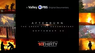
Afterburn: The Creek Fire Documentary Teaser
Never before seen accounts from the fire line and how Shaver Lake was saved. (3m 24s)
Providing Support for PBS.org
Learn Moreabout PBS online sponsorship
- News and Public Affairs

Top journalists deliver compelling original analysis of the hour's headlines.

- News and Public Affairs

FRONTLINE is investigative journalism that questions, explains and changes our world.


Support for PBS provided by:
Valley PBS Original Documentaries is a local public television program presented by Valley PBS